Check Points, Route, & Altitude
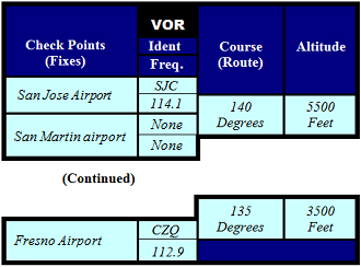
The following columns of the "Navigation Log" provide a convenient way to obtain and list the following route-related information used for determining the Route of Flight, and pre-flight navigation planning:
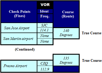
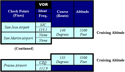
- Check Points: Set of selected recognizable landmarks along the Route of Flight that can be positively identified from the air
- VOR: VHF Omni-directional Range: Instrument located in the aircraft's Instrument Panel that is the most commonly used radio navigational system in the U.S.
- Course: True Course: Intended direction of flight, as measured on the "Chart"
- Altitude: Cruising Altitude: Level portion of aircraft travel displayed by the Altimeter, occurring between the ascent and descent phases, and usually the majority of the journey
Obtained from your "Chart"
Task:
- For the Departure Point: Perform the following sub-steps:
- Obtain the "Departure Point" from the "Flight Plan" section, and enter it as follows.
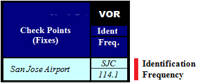
- Obtain the VOR (Identification & Frequency) from your "Chart," and enter it as follows.
- Perform the following sub-steps to determine the Check Points and Destination:
- Plot the Route of Flight, using your "Chart" and Plotter.
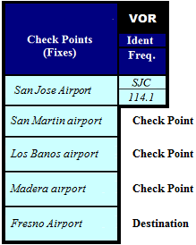
- Determine the Check Points, obtain the "Destination" from the "Flight Plan" section, and enter them as follows.
|
NOTE: These Check Points will determine the beginning- and end-points for each Individual Leg.
|
- For each Check Point and the Destination: Perform the following sub-steps:
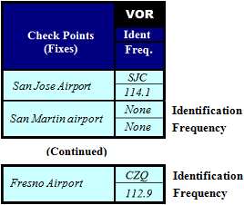
- Obtain the VOR Identification & Frequency from your "Chart," and enter them as follows.
- Plot a Course from the previous Check Point, using your "Chart" and Plotter, and enter it as follows.
- Determine the Cruising Altitude, and enter it as follows.
- Determine the highest Cruising Altitude (from Step 3), and enter it into the "Flight Plan" section as follows.
- Determine the Route of Flight, using the Check Points (from Step 2), and enter them into the "Flight Plan" section as follows.
